


Matrix Geo Solutions Secures North Western Railway Contract for Drone-Led Project Monitoring
Matrix Geo Solutions Limited, a geospatial technology and engineering
consultancy, has received a Letter of Acceptance from North Western Railway for
project monitoring of the ongoing Luni–Samdari–Bhildi double line project.
The contract with North Western Railway, headquartered in Jaipur,
involves aerial videography-based monitoring of the 271.97 km rail corridor
using drone systems. The project will be executed over a period of 30 months,
with a total contract value of INR 3,07,62,599.51.
As railway
infrastructure projects expand in scale and complexity, the need for
continuous, accurate, and data-backed monitoring has become more critical.
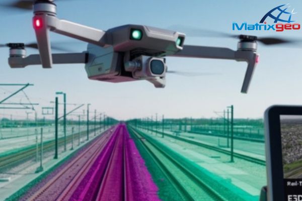
Through drone-led aerial surveys and high-frequency data capture, the project
will enable better tracking of construction progress, early identification of
deviations, and improved coordination across stakeholders.
On a
monthly basis, advanced UAVs equipped with high-resolution cameras and sensors
will capture 4K geo-tagged video data along the alignment, with precise GPS
metadata mapped to each frame. This data will be post-processed to enable
change detection across the corridor, covering key construction stages such as
earthwork, ballast laying, rail installation, bridge construction, and
associated infrastructure development. The approach is expected to support
tighter timelines, enhance on-ground safety, and bring greater transparency to
project execution.
Speaking
on the project win, Amit Sharma, Whole Time Director, Matrix Geo
Solutions Limited, said, “This mandate from North Western Railway
further expands our work in railway infrastructure projects. Corridors of this
scale require continuous oversight and precise data to keep execution on track.
Through UAV-led monitoring, we aim to provide clear, real-time visibility into
progress, enabling faster decision-making and better coordination. We are
confident in our ability to support efficient execution while maintaining
strong control over timelines across the project lifecycle.”
The use of
drone-led monitoring is also expected to deliver measurable efficiencies,
including a reduction of approximately 50% in the need for physical site visits
by senior officials, a decrease of around 25% in reporting turnaround time, and
improved visibility into critical project locations through real-time drone
feeds.
Matrix Geo
Solutions brings more than 25 years of experience across the USA, Europe,
Africa, and Asia, delivering high-precision geospatial intelligence for
large-scale infrastructure and industrial projects, including railways,
highways, mining, water resources, power transmission, oil and gas, and urban
development.
The
company’s capabilities span satellite imagery, drone-enabled data capture,
aerial mapping, mobile mapping, GIS, and remote sensing, enabling accurate and reliable
insights for planning, monitoring, and execution. This depth of experience
positions the company to manage complex, multi-kilometre projects such as the
Luni–Samdari–Bhildi double line corridor, where precision, consistency, and
timely data are critical to maintaining alignment with on-ground realities.
Leave A Comment